
BIOGEOGRAPHICAL AND ECOLOGICAL OVERVIEW
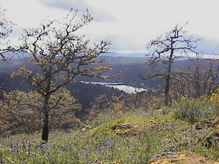
Garry Oak (Quercus garryana) on Vancouver Island,
photo by Brian Klinkenberg.
by
Brian Klinkenberg
Understanding the botany of a region means understanding where plants occur, why they occur there, and in what combinations. That is, understanding the flora of that region and the vegetation patterns that result, and understanding the ecology of the species that make up the vegetation. The flora of a region is defined as all of the plants that occur naturally, or have naturalized, in that region. The vegetation of a region is defined as the patterns or combinations of species that occur on different landforms, and in different climatic zones.
Our Flora and the Phytogeography of BC
The flora of British
Columbia,whether terrestrial or aquatic, is comprised of plant species that have "arrived" in British
Columbia over time. Species arrive in different ways, some
of them through natural range expansion (e.g., moving northward
during a period of climate change--native
species), others arrive as a result of human activity
(e.g., weeds that arrive with crops--alien
species). Our BC flora (moss flora, algae flora, vascular plant flora, etc.) is made up of many native
and alien species, and understanding how they arrived here and where they came from is called
floristics. The study of floristics or phytogeography is the study of the number, distribution, origin, and relationships of plant species in one or more areas. In Volume 8 of the Illustrated Flora of British Columbia, authors George Douglas, Del Meidinger and Jim Pojar provide a detailed discussion of the phytogeography of the vascular plant species of British Columbia. That information is now available on E-Flora.
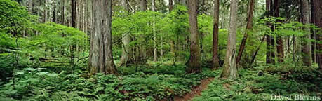
Old growth forest, photo by David Blevins.
The Vegetation and Ecosystems of BC
The vegetation of British Columbia varies from forest associations, such as the coastal Douglas-fir forests, to savannas, grasslands, meadows and wetlands. We have marine vegetation that includes components such as the kelp forests. The non-marine vegetation in the province has been well-described by Meidinger and Pojar (1991) in The Ecosystems of British Columbia. A modified version of that write-up, by Del Meidinger, is available on E-Flora BC.
In order to understand the variation in vegetation in a region, botanists classify vegetation into different types. There are several ways of classifying vegetation. In BC, the non-marine vegetation patterns of the province have been described under the biogeoclimatic zones of BC (Biogeographic Ecosystem Classification or BEC zones), which provide an ecological framework for the province. The BEC zones are a land classification system developed by the BC Ministry of Forests. Derek Marcoux of Selkirk College has produced a very informative site that provides an educational perspective on BEC zones in BC. At Derek's site you can go through a comprehensive overview of the BEC zone classification in BC (e.g., you can access pictures and descriptions of the major zones, and view four cross-sections of the province illustrating the relation among the zones and BC's topography). Derek's pages are definitely worth viewing if you wish to learn more about the BEC zones in BC.
Ecological Frameworks for BC Species: BEC Plots and E-Flora BC
Learning what a plant species needs to grow is part of learning about the flora. If you know what kind of site conditions a species prefers, then searching for new occurrences can be targeted. In BC, the provincial BEC vegetation surveys have been based upon plot analysis. BEC botanists have analyzed plots across the province, in different vegetation types, and documented the species that occur in them. Their focus has been on forest and forest-associated species and vegetation types.. This plot information is invaluable. It has allowed us to take a close look at the preferred growing conditions for many species, those that appear in the plots where surveyors have documented site factors, including slope, aspect, elevation and so on. In E-Flora BC, we have taken that plot information and calculated the range of growing conditions for the species covered by the plots, producing ecological frameworks for many BC species. This has given us insight into the requirements for many species. Read more about the analysis on our Ecological Framework discussion page. View a sample atlas page which contains a species Ecological Framework.
Biogeography and Ecology on E-Flora BC
In this section of E-Flora BC, we present introductions to the vegetation and flora of the province written by provincial experts, an introduction to Garry oak ecosystems in BC, and an introduction to how we determined the ecological frameworks for many BC species. This is information is important for understanding why plants species grow where the do, what they need to grow, and how they interact to form alliances throughout the province as a result of the interaction of geographic factors such as climate, precipitation, and geology. To learn more about specific species requirements, visit the species atlas pages. Our interactive maps allow you to investigate species occurrence and the associated physical features that support them.
Read about the terrestrial vegetation of BC.
Read about the flora (phytogeography) of BC.
Read about Garry oak ecosystems of BC.
Read about developing ecological frameworks for BC species.
Recommended citation: Author, date, page title. In: Klinkenberg, Brian. (Editor) 2023. E-Flora BC: Electronic Atlas of the Flora of British Columbia [eflora.bc.ca]. Lab for Advanced Spatial Analysis, Department of Geography, University of British Columbia, Vancouver. [Date Accessed]
E-Flora BC: An initiative of the Spatial Data Lab, Department of Geography UBC, and the UBC Herbarium.
© Copyright 2023 E-Flora BC.